Property Record
880 Facet Rd, Henderson, NC 27537

NEARBY LISTINGS FOR SALE OR LEASE
Property Detail
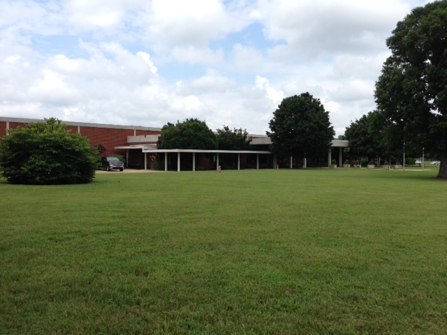
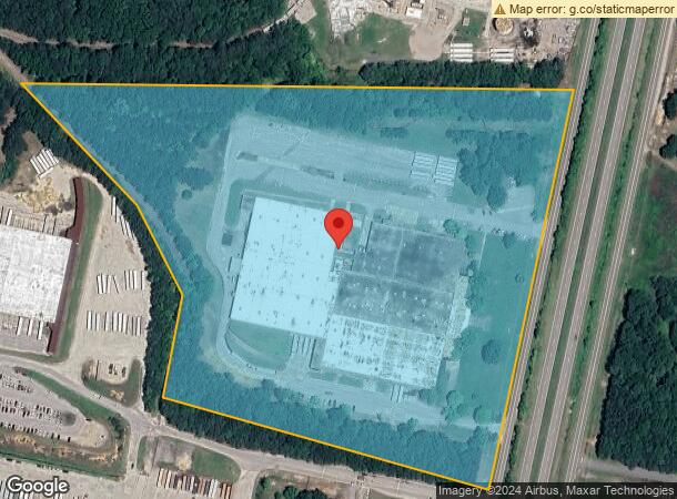
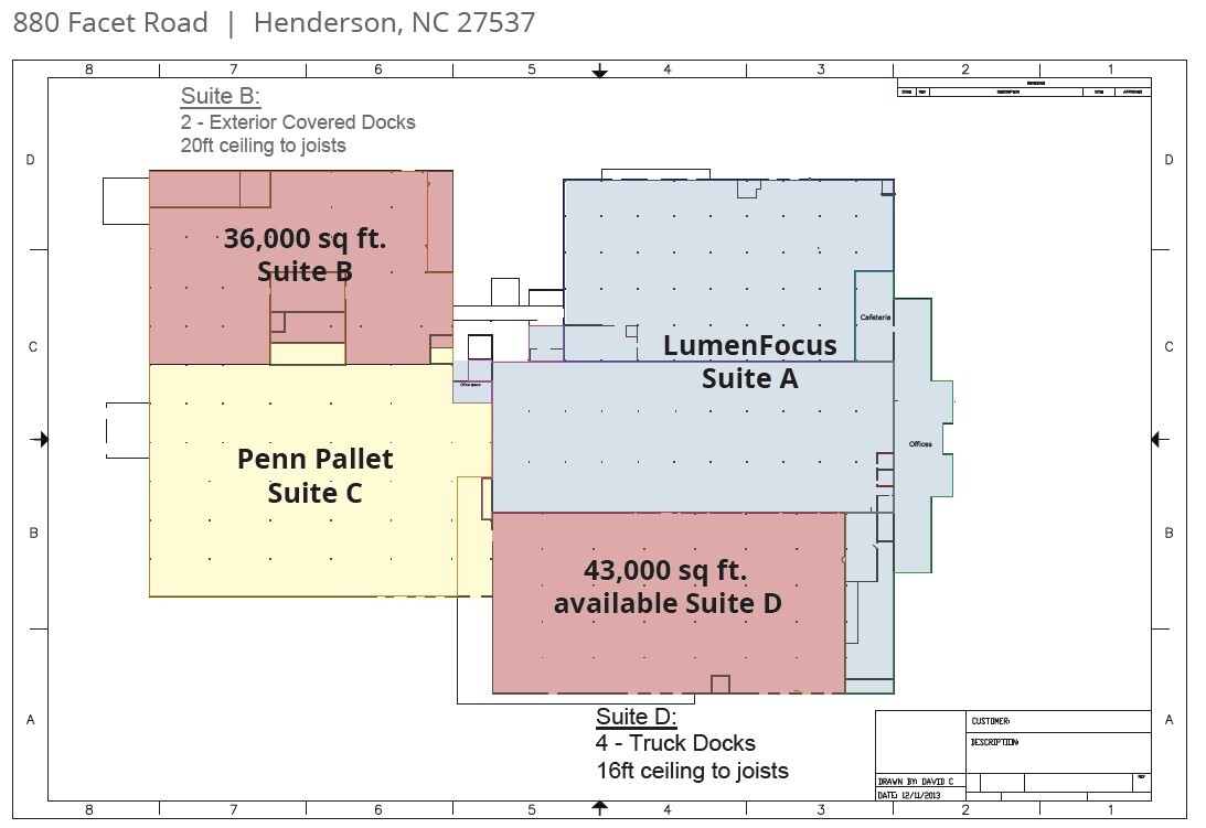
880 Facet Rd
0224-02023
880 FACET RD 25.24
Distributionwarehouseregional
Vance
X
North Carolina
3720196200K
25.24 AC
2024
North Carolina Northeast Area
2024
Other Market Areas
9608002023
Henderson, NC
214,900 SF
DEMOGRAPHICS near 880 Facet Rd
1 Mile
3 Mile
5 Mile
2024 Total Population
795
14,608
27,353
2029 Population
793
14,532
27,121
Pop Growth 2024-2029
(0.25%)
(0.52%)
(0.85%)
Average Age
39
40
40
2024 Total Households
304
5,578
10,884
HH Growth 2024-2029
(0.33%)
(0.47%)
(0.82%)
Median Household Inc
$40,625
$37,358
$40,262
Avg Household Size
2.60
2.50
2.40
2024 Avg HH Vehicles
2.00
2.00
2.00
Median Home Value
$85,848
$90,606
$107,932
Median Year Built
1982
1972
1975
Nearby Places
- Restaurants
- Banks
- Shops
- Fitness
- Groceries
SALE & LEASE HISTORY
LISTING DATE
SALE/LEASE

Sep 25, 2016
For Lease
May 07, 2018
For Sale
Mar 24, 2017
For Lease
Aug 18, 2020
For Lease
Nearby Properties
Address
Land Use
TOTAL SIZE
Lot Size
Zoning
Address
Land Use
TOTAL SIZE
Lot Size
Zoning
149,688 SF
131.64 AC
HI2
Address
Land Use
TOTAL SIZE
Lot Size
Zoning
603,204 SF
45.50 AC
HI2
Address
Land Use
TOTAL SIZE
Lot Size
Zoning
230,400 SF
69.68 AC
HI2
Address
Land Use
TOTAL SIZE
Lot Size
Zoning
95,555 SF
13.80 AC
HB4
Address
Land Use
TOTAL SIZE
Lot Size
Zoning
96,081 SF
1.33 AC
HB1
Address
Land Use
TOTAL SIZE
Lot Size
Zoning
51,768 SF
40.75 AC
HR8M
Address
Land Use
TOTAL SIZE
Lot Size
Zoning
64,208 SF
1.90 AC
HB1
Address
Land Use
TOTAL SIZE
Lot Size
Zoning
257,656 SF
31.28 AC
HI2
Address
Land Use
TOTAL SIZE
Lot Size
Zoning
167,900 SF
70.82 AC
HR15
Address
Land Use
TOTAL SIZE
Lot Size
Zoning
117,068 SF
31.86 AC
HI2
Address
Land Use
TOTAL SIZE
Lot Size
Zoning
22,572 SF
88.80 AC
HR15M
Address
Land Use
TOTAL SIZE
Lot Size
Zoning
24,888 SF
33.39 AC
HR20
Address
Land Use
TOTAL SIZE
Lot Size
Zoning
54,793 SF
47.70 AC
HR15
Address
Land Use
TOTAL SIZE
Lot Size
Zoning
158,500 SF
12.24 AC
LI
Address
Land Use
TOTAL SIZE
Lot Size
Zoning
27,784 SF
2.06 AC
HB1
Address
Land Use
TOTAL SIZE
Lot Size
Zoning
78,661 SF
4.84 AC
HOI
Address
Land Use
TOTAL SIZE
Lot Size
Zoning
56,315 SF
8.69 AC
HB4
Address
Land Use
TOTAL SIZE
Lot Size
Zoning
48,490 SF
6.14 AC
HB2A
Address
Land Use
TOTAL SIZE
Lot Size
Zoning
109,130 SF
26.76 AC
Address
Land Use
TOTAL SIZE
Lot Size
Zoning
62,129 SF
26.02 AC
OI
Address
Land Use
TOTAL SIZE
Lot Size
Zoning
12,000 SF
1.50 AC
HI2
Address
Land Use
TOTAL SIZE
Lot Size
Zoning
213,673 SF
8.05 AC
HI2
Address
Land Use
TOTAL SIZE
Lot Size
Zoning
55,900 SF
16.19 AC
Address
Land Use
TOTAL SIZE
Lot Size
Zoning
65,156 SF
46.85 AC
HI2
Address
Land Use
TOTAL SIZE
Lot Size
Zoning
14,672 SF
2.85 AC
HB4
Address
Land Use
TOTAL SIZE
Lot Size
Zoning
142,426 SF
14.41 AC
HI2
Address
Land Use
TOTAL SIZE
Lot Size
Zoning
35,775 SF
11.97 AC
HB4
Address
Land Use
TOTAL SIZE
Lot Size
Zoning
96,000 SF
14.98 AC
HI2
Address
Land Use
TOTAL SIZE
Lot Size
Zoning
12,664 SF
9.14 AC
HB4
The World's #1 Commercial Real Estate Marketplace
Connect with us
© 2025 CoStar Group
The information above has been obtained from sources believed reliable. While we do not doubt its accuracy we have not verified it and make no guarantee, warranty or representation about it. It is your responsibility to independently confirm its accuracy and completeness. Any projections, opinions, assumptions, or estimates used are for example only and do not represent the current or future performance of the property. The value of this transaction to you depends on tax and other factors which should be evaluated by your tax, financial, and legal advisors. You and your advisors should conduct a careful, independent investigation of the property to determine to your satisfaction the suitability of the property for your needs.